Data collection from the air and mapping using drones have become indispensable tools across various industries, from urban planning to agriculture and disaster management. Professionals can efficiently gather precise spatial information by leveraging cutting-edge technology such as drones and aerial surveys. In this comprehensive guide, we’ll delve into the step-by-step process of Aerial Mapping Geospatial Data – Photogrammetry, empowering individuals to navigate this exciting field with confidence.
It’s crucial to clearly outline your objectives. The goals you define will shape the entire process, from selecting the right equipment to interpreting the collected data accurately. Whether you’re mapping terrain for construction planning or monitoring crop health, defining your objectives is essential.
Choosing the appropriate platform for aerial data collection depends on various factors such as area size, resolution requirements, and environmental conditions. Options range from drones equipped with cameras to manned aircraft and satellites. Drones, in particular, offer flexibility, cost-effectiveness, and accessibility for small to medium-scale projects, making them a popular choice among professionals.
Effective mission planning is the cornerstone of successful aerial data collection. Begin by conducting a thorough survey of the area, identifying potential obstacles and safety hazards. Utilize specialized software, such as DroneDeploy or Pix4D, to design flight paths, ensuring optimal coverage and data quality. Take into account factors like altitude, overlap, and camera settings to achieve the desired level of detail.
With the mission plan in place, it’s time to execute the flight. Conduct pre-flight checks to verify equipment functionality and calibration, paying close attention to weather conditions and airspace regulations. Once airborne, monitor the flight closely to ensure smooth operation and make any necessary adjustments in real-time. For larger projects, consider implementing automated flight modes to streamline the process and enhance efficiency.
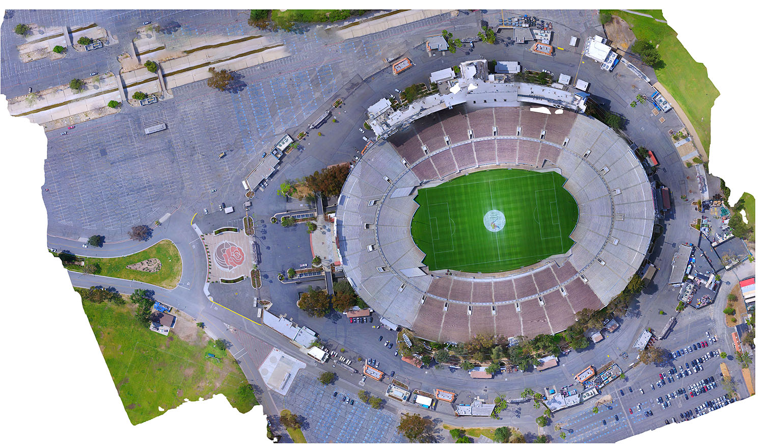
During the flight, the chosen platform will capture a wealth of aerial imagery or sensor data, depending on your specific requirements. Once the data collection is complete, it’s essential to process and analyze the raw information effectively. This typically involves stitching together multiple images to create seamless mosaics, employing photogrammetry techniques to generate 3D models, and applying geospatial algorithms for feature extraction and analysis.
With processed data in hand, it’s time to transform it into actionable insights through map generation and visualization. Utilize Geographic Information System (GIS) software like ArcGIS or QGIS to create detailed maps, layering information such as elevation, land use, and infrastructure. Incorporate advanced visualization techniques, including heat maps and contour plots, to enhance data interpretation and decision-making.
The final step involves interpreting the mapped data and sharing findings with stakeholders or clients. Collaborate with subject matter experts to extract meaningful insights from the spatial information, identifying trends, patterns, and potential areas for improvement. Present the findings through interactive maps, reports, or presentations, facilitating informed decision-making and driving positive outcomes.
Aerial Mapping Geospatial Data – Photogrammetry represent a powerful fusion of technology and geography, empowering professionals across industries to gain invaluable insights into the world around us. By following this step-by-step guide, you can navigate the complexities of the process with ease, from defining objectives to sharing actionable findings. Embrace the possibilities of aerial data collection, and unlock a new realm of opportunities for innovation and exploration in your field.
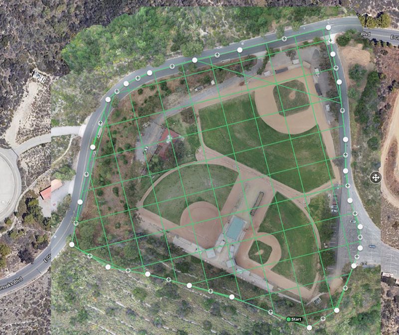
Scan Area 20 Acres
Drone Altitude 200 Ft.
Number of photos 300
Contact us:
Scan Area 40 Acres
Drone Altitude 175 Ft.
Number of photos 350